• Skip to primary navigation
  • Skip to main content
  • Skip to footer
Dorion Geological Services

Dorion Geological Services

200 High Street, Suite #1C
Portland, ME 04101
207-944-9049

  • Soil Surveys & HSG Determination
  • Wetland Delineation
  • Notices of Violation (NOVs)
  • Organic Land Care
  • Geoarchaeology
  • Contact

High Intensity Soil Survey & Hydrologic Soil Group (HSG) Determination

We provide varying levels of high intensity soil surveys tailored to properly address a client’s land use and management objectives.

Efficient use and management of Maine’s soils arises from the careful study, description, and mapping of land areas. Agricultural products, drinking water supplies, timber resources, road construction activities, waste water disposal, pollution mitigation, building sites, town planning, recreation areas, conservation lands, and untold other intricacies of life are directly linked to proper utilization of Maine’s varied soils.

Wind power and solar projects require high intensity soil surveys with accompanying HSG determinations.
Transmission line, natural gas pipelines, and similar infrastructure also require high intensity soil surveys with accompanying HSG determinations.
An excavator-dug soil test pit to determine HSG and suitability for storm water infiltration and attenuation.

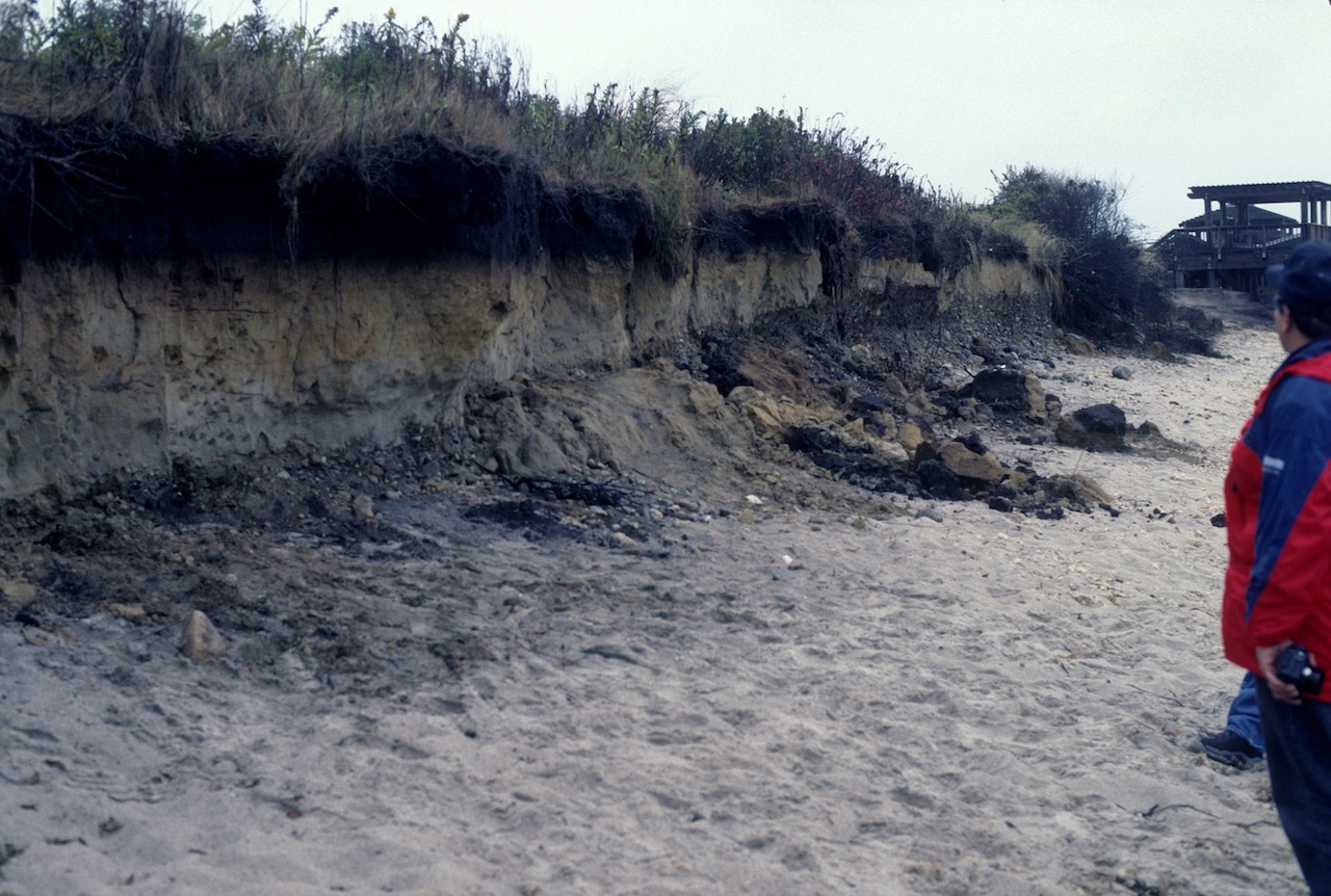
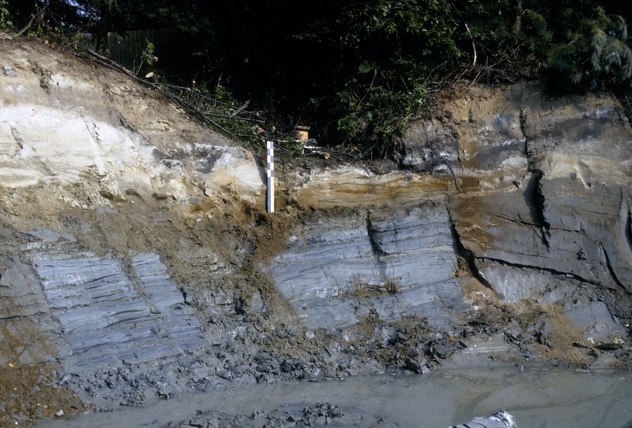
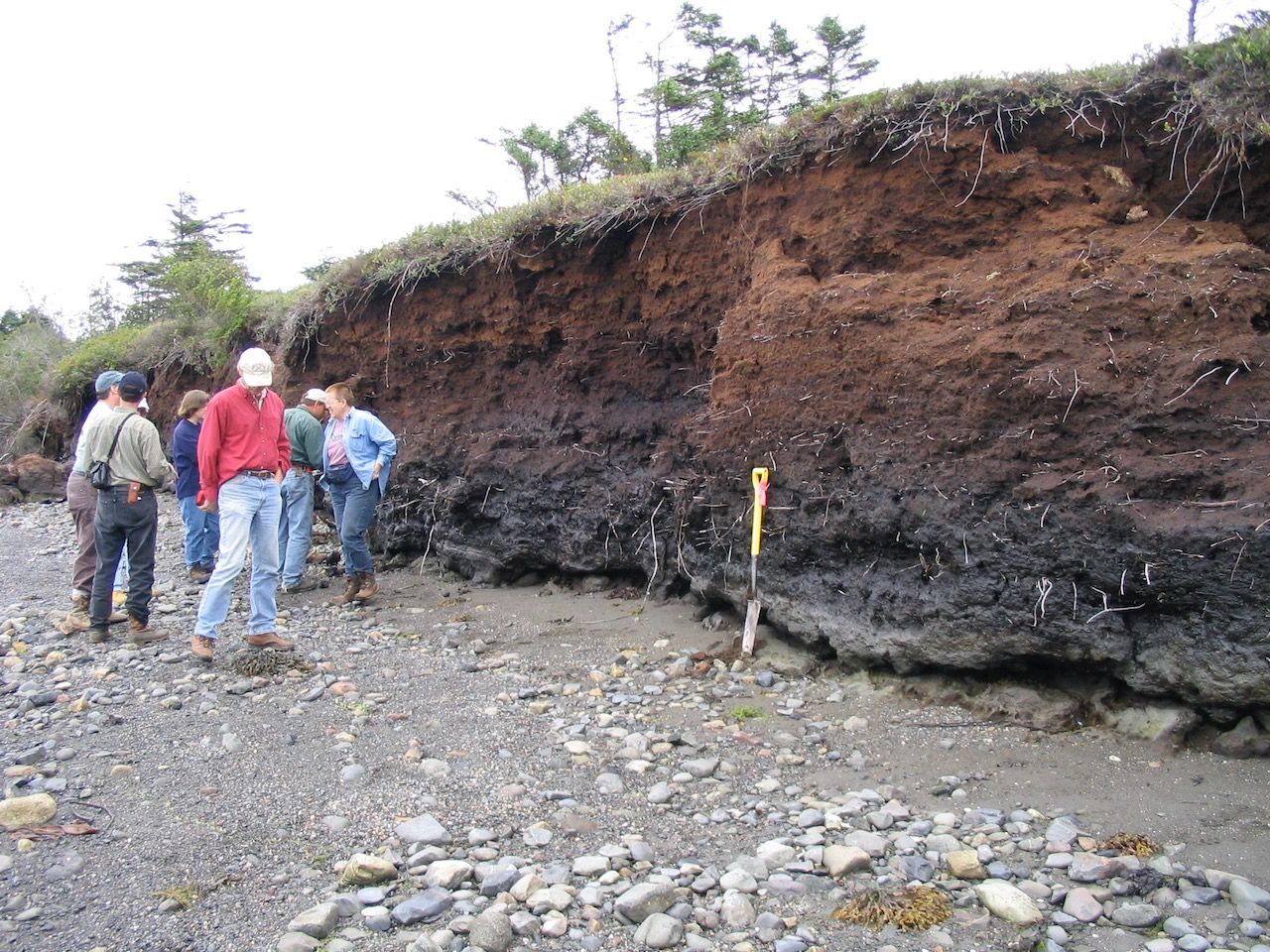
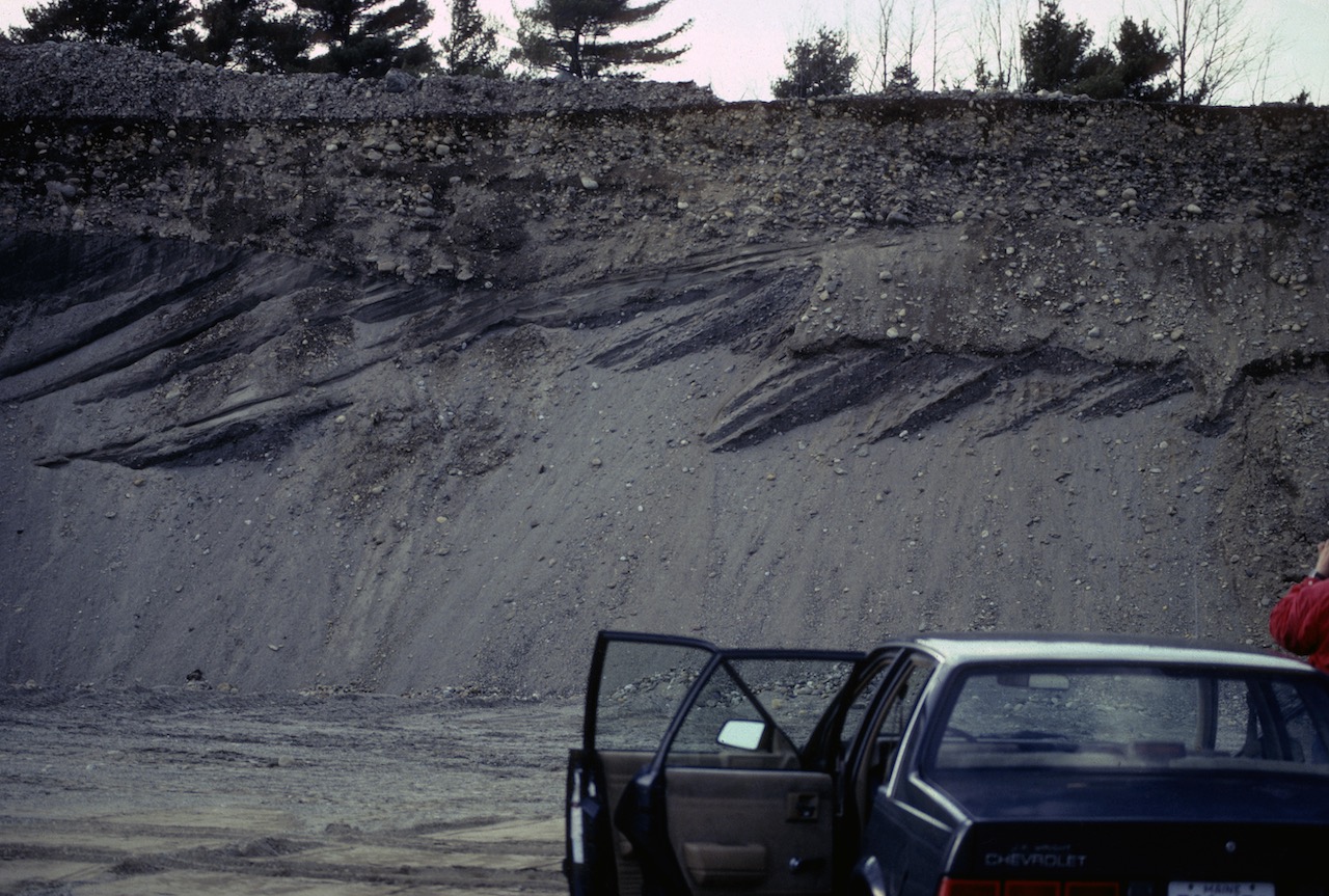
The thin veneer of unconsolidated sediment overlying Maine’s bedrock was deposited beneath and at the terminus of the Laurentide ice sheet 11,000 to 15,000 years before present. These heterogeneous sediments are collectively called “parent material”. There are 5 broad classes of parent materials in Maine:

  • Sand and gravel deposits
  • Loose ablation till
  • Dense basal till
  • Marine/lake silty clay sediments
  • Peat (organic) deposits

In the upper part of these parent materials, soils have slowly formed since deglaciation.


Soil Mapping

A high intensity soil survey maps parent material distribution, depth to bedrock, depth to the seasonal high water table, or drainage class, texture, rock fragments within the soil profile, surface stoniness, slope, HSG, and recommended use and management.
The above photo shows a typical soil profile from the lowlands and major river valleys of Maine. Sand overlies the Presumpscot Formation “blue clays”. This relationship causes infiltrating rain and snowmelt to become perched at the sand – blue clay interface, resulting in a high seasonal water table, affecting use and managment such as building foundations, road subgrades, utilities, and storm water design. Secondly, the Presumpscot Formation has low soil strength when saturated, produces significant frost heaving, and becomes very firm when dry, creating challenging lawn and field management conditions.
The above photo shows a typical soil profile from a poorly drained, or hydric soil. This drainage class, together with the Very Poorly Drained drainage class, underlie wetlands in Maine. The alternating soil colors of gray and rusty orange are the result of seasonal soil saturation and seasonal soil drying. Tape is marked in cm.
Carrying Place Bluff. A field conference reviewing hydric soils. The attendees are standing on the modern beach. At the base of the shovel are late Pleistocene (ca. 14,000 year old) glacial marine sediments (gray colors). Above these sediments are black freshwater lake deposits, marking the transition from marine to freshwater. From this level to the present ground surface is the entirety of time since humans first arrived here ca. 12,000 years ago.
Maine contains abundant sand & gravel resources, such as this glacial marine delta. They function as significant aquifers, sources for construc- tion materials and roads, agriculture, wild blueberry cultivation, and many other uses. They have been mapped by the Maine Geological Survey. Maine towns and cities subsequently adopted land use ordinances to protect these deposits as an “aquifer protection overlay district”. These deposits are the parent material “glaciofluvial deposits” and represent ~ 20 named soil series.

Soil Map Intensity

Different levels of soil map intensities can match particular land use objectives. For example, the U.S.D.A. Natural Resources Conservation Service county soil maps were developed at scales of 1:15,840 (1 map inch = 1,320 ft. on the ground) or smaller scale. High intensity soil surveys, utilizing mapping scales of 1 map inch = 200 ft. on the ground, and up to 1 in. = 50 ft., can provide the detail needed for intensive land uses such as building construction, stormwater design, erosion and sediment control planning, natural resource protection, and other uses.

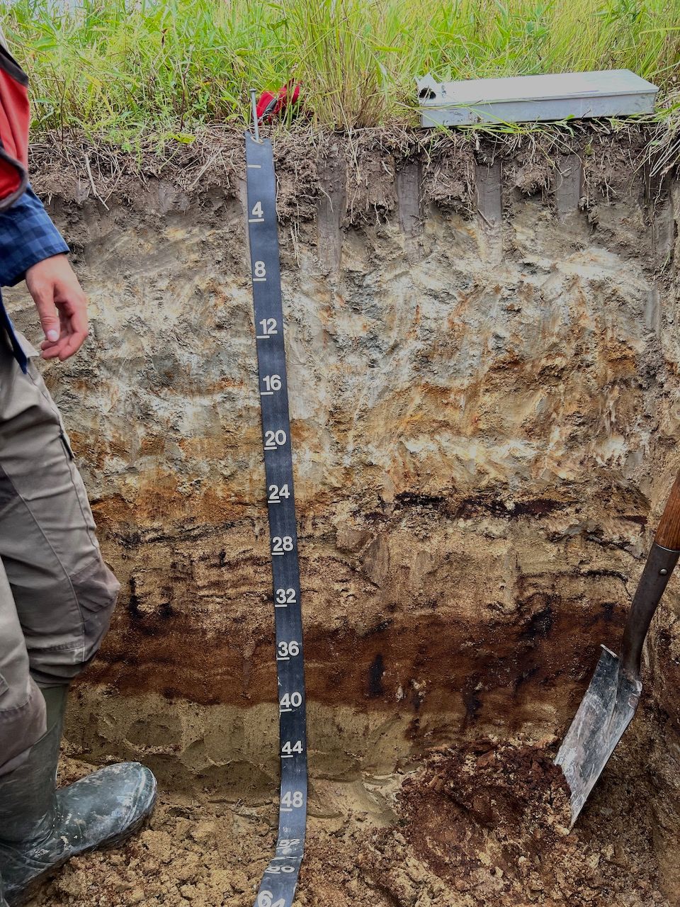
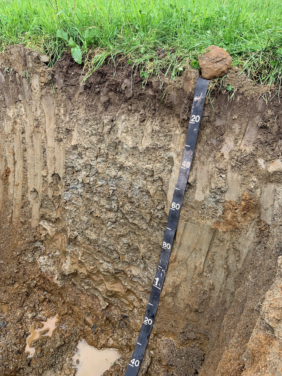
Soil Test Pit Log (MDEP Form F)

Integral to, and accompanying the high intensity soil map, is a report containing the soil test pit logs and descriptions of soil map units which explain specific properties and limitations of each soil – texture, coarse fragments, drainage class (depth to seasonal high water table), restrictive layers, parent material, hydrologic group, slope, geomorphology, surface stoniness, and depth to bedrock. Soil test pits are dug by backhoe or excavator and allow for full soil descriptions down to 60 inches or deeper (remotely, i.e., depth to bedrock data) below ground surface.

Footer

200 High Street, Suite #1C,
Portland, ME 04101
207-944-9049

  • Maine Licensed Geologist #GE485
  • New Hampshire Professional Geologist #795
  • Maine Licensed Soil Scientist #SS454
  • Maine Certification in Erosion and Sedimentation Control Practices – MDEP
  • N.O.F.A. Accredited Organic Land Care Professional

Copyright © 2025 · C.C. Dorion Geological Services · site by iKnow